


Archaeology Weekend: Sheffield Manor Lodge and the Ancient Sites of the Peak District
An archaeology weekend that starts at Sheffield Manor Lodge and continues into the Peak District covers an unusually long span of human activity. The manor's remains reflect Saxon, medieval and Tudor occupation, while the uplands hold stone circles, earthworks and hillforts from much earlier periods. The contrast makes a useful lesson in how landscapes collect meaning over thousands of years.
The plan below suits visitors with an interest in archaeology and enough stamina for uneven ground. It emphasises looking and reading the landscape rather than digging or handling finds, and it stresses the care that monuments need. Several of the sites are scheduled monuments, so the rule is to stay on the paths and leave everything where it lies.
The Archaeology at Sheffield Manor Lodge
Archaeological work has shaped how the manor is understood today. The remains of the old park, the earthworks and the ruined walls give a clear sense of how the site was laid out over time. Walking the site with that in mind helps you see the difference between features that belong to the Saxon-era landscape and those that date from the later Tudor residence. Look for changes in ground level, straight lines in the grass and stone that has been reused from earlier buildings.
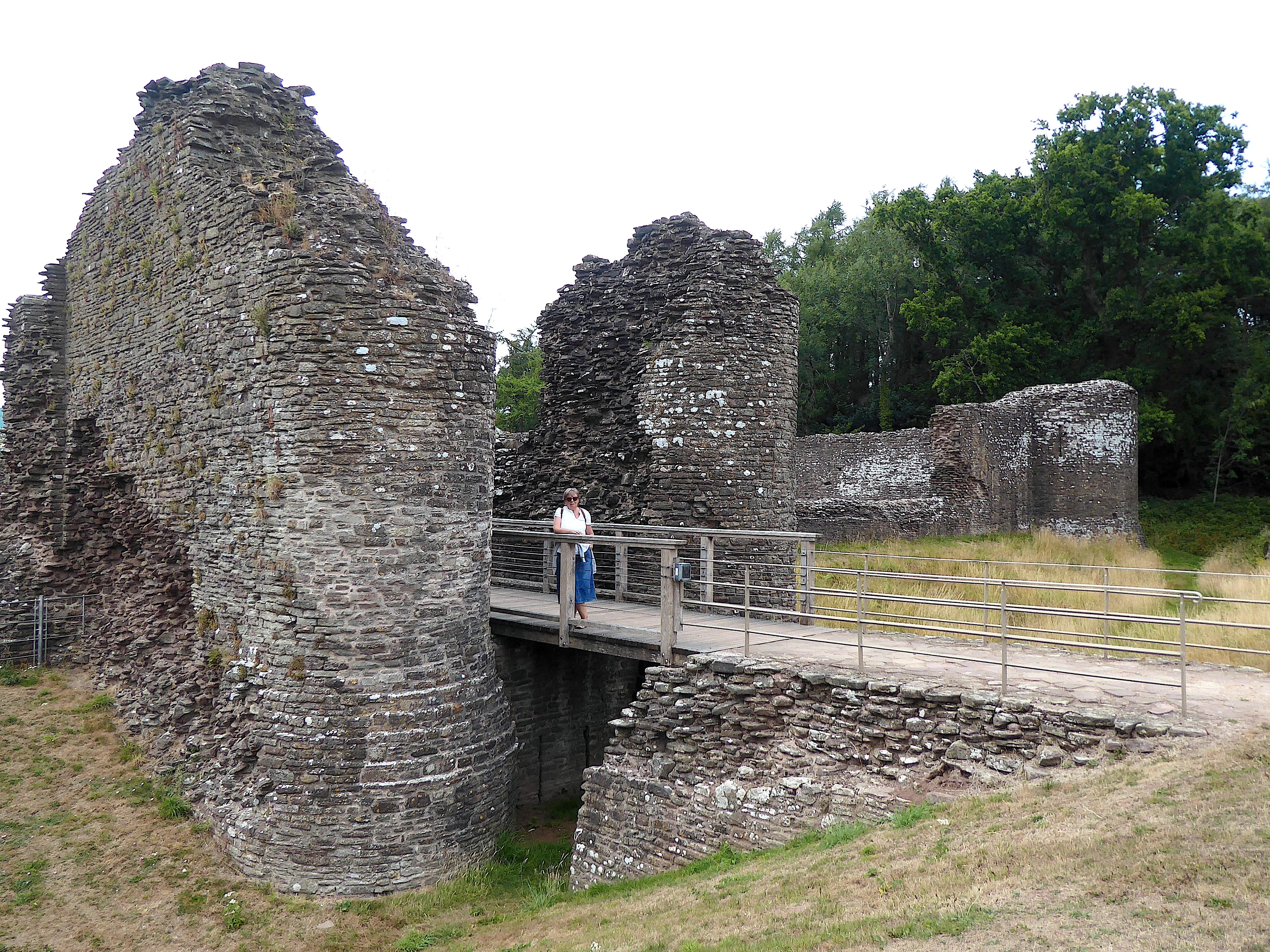
The archaeology pages on the site describe the practical side of the work, including how features are recorded and interpreted. Reading them before the visit gives you a vocabulary for the features on the ground, which makes the rest of the weekend more rewarding. The history overview adds the chronology needed to place each feature in its period, and it helps you ask better questions when you reach the Derbyshire sites.
It is worth remembering that much archaeology is found by careful observation rather than excavation. Ridges, hollows and patches of different vegetation can indicate buried foundations, and many discoveries begin with someone noticing an odd shape in a field. Bring a notebook and make a sketch of anything that looks out of place, since these notes often prove useful later.
Arbor Low: A Neolithic Monument in Derbyshire
Arbor Low is a Neolithic monument on the limestone plateau of the White Peak. It consists of a circular bank and ditch with a ring of stones, many of which now lie flat, and it is often described as one of the most important prehistoric sites in Britain. Its setting, with wide views across the surrounding fields, makes the scale of the monument easy to appreciate. Walking the circuit of the bank is the best way to understand how the enclosure was designed.
Visitors should expect an exposed site with limited shelter. Paths can be wet, and the stones are fragile and should not be climbed on or touched more than necessary. Take a map of the site, and allow time to walk the full circle of the bank before deciding what you think the monument was used for. Interpretation at the site is limited, so the notes you prepare beforehand will help a great deal.
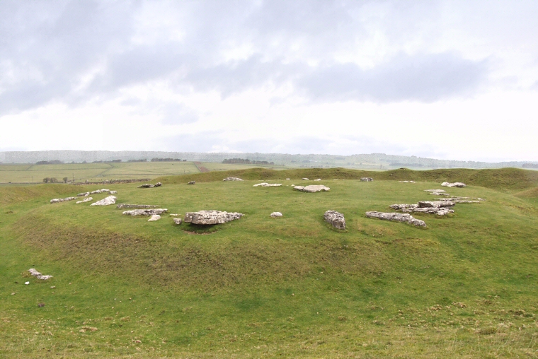
The monument's purpose is still debated by archaeologists. Some interpretations link it to ceremonial gatherings, others to the organisation of local communities. Reading a short summary before the visit lets you weigh the evidence yourself, rather than accepting a single explanation as settled fact.
Nine Ladies and Stanton Moor
The Nine Ladies is a Bronze Age stone circle on Stanton Moor, near the village of Birchover. The circle is small and easy to reach, and it sits close to other burial monuments that give a sense of the wider ritual landscape. A short walk across the moor links the stone circle with the nearby cairns and the stone outcrops that visitors often photograph. The circle is an ideal first stop for a relaxed afternoon.
The site is a good example of how prehistoric monuments are often placed to command views or to sit on routes between places. Stand inside the circle and look out across the moor, then consider why this particular spot was chosen. Stanton Moor is a popular walking area, so keep to the paths and follow any local guidance on dogs and litter. Please do not touch or climb on the stones, since even small amounts of wear add up over time.
The moor also has a long history of quarrying, and the stone outcrops show the marks of past work. Recognising these scars helps you separate the natural shape of the rock from the human changes that happened much later, which is a useful habit on any archaeology walk.
Mam Tor and Carl Wark: Iron Age Hillforts
Mam Tor, above Castleton, is an Iron Age hillfort with a substantial earthwork that runs along its summit. The ramparts are clearly visible from below, and the climb to the top offers views across the Hope Valley. Parts of the slope have been affected by landslides over time, so the monument's shape is not as it was when first built, and the path can be steep and uneven.
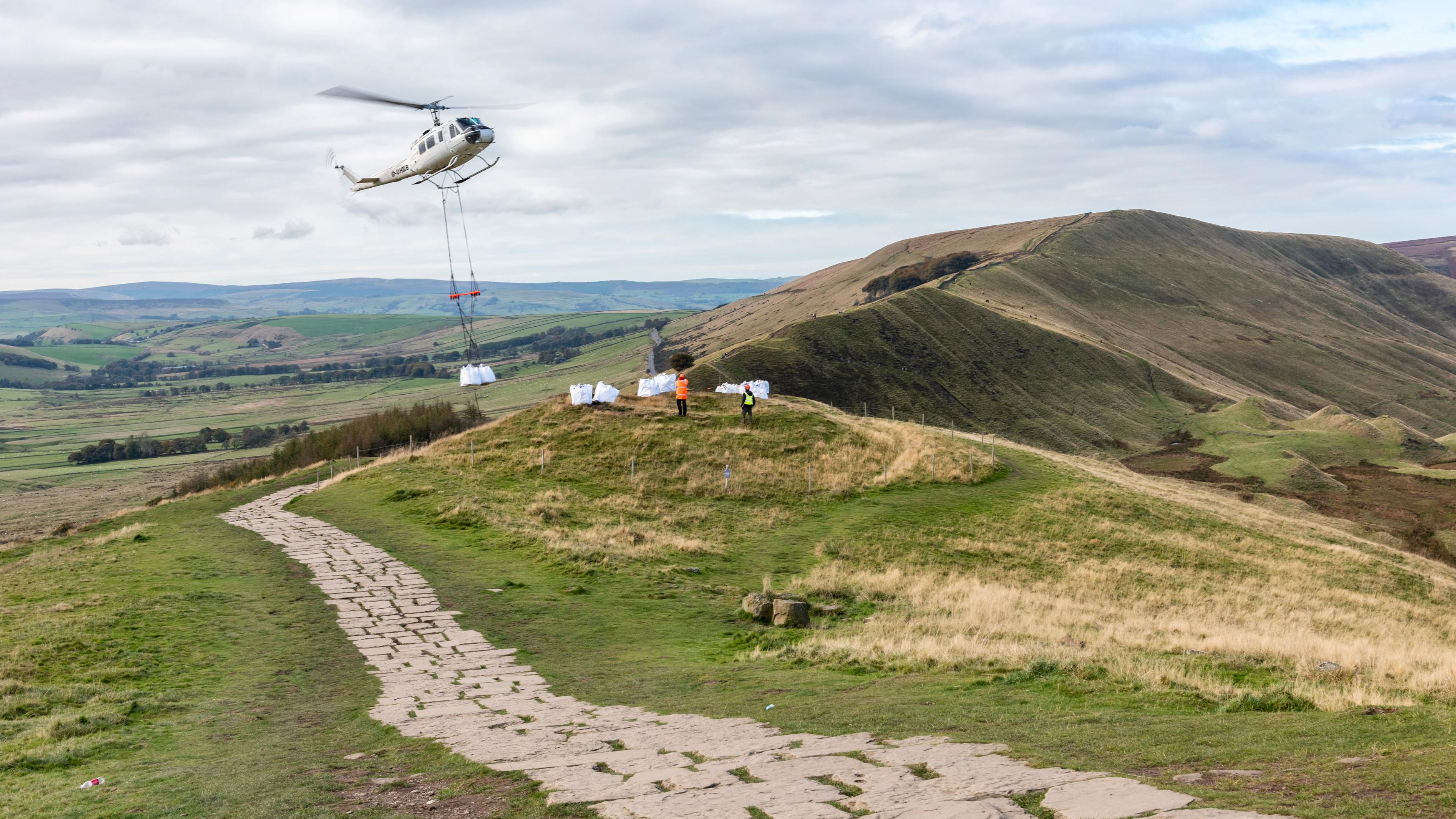
Carl Wark, near Hathersage, is another Iron Age hillfort, with a rocky enclosure that looks very different from the grassy ramparts of Mam Tor. Its rugged surface and wide gateway make it a striking contrast, and the walk to reach it passes through moorland that is ideal for reflecting on the choices people made when building defensive sites in this landscape. Compare the two forts side by side and consider why their builders chose such different approaches.
Hillforts often had clear views of the routes that passed beneath them, which helps explain why they were placed where they are. Standing on the ramparts, you can trace the valleys and passes that would have mattered to the people who lived here. This is one of the most rewarding ways to connect the landscape with the story of the past.
A Two-Day Archaeology Plan
The steps below give one way to organise the weekend. They assume a base in Derbyshire and a visit to the manor at the start of the trip, but the order can be changed to suit your travel plans. Each step is short enough to complete without rushing, which leaves time to look and to make notes.
- Visit Sheffield Manor Lodge in the morning and read the site's archaeology and history pages on arrival.
- Drive or travel by bus into the Derbyshire base and check the route to each monument before dark.
- On the first afternoon, visit Nine Ladies on Stanton Moor, which is short and suits a relaxed pace.
- On the second morning, start early at Arbor Low while the light and the site are quiet.
- Finish with a walk up Mam Tor or a visit to Carl Wark, depending on the weather and your energy.
- Use the discovery centre at the manor as a place to review your notes before the journey home.
Keep a simple log of each stop, with the date, the weather, one feature you noticed and one question you still have. The log turns a weekend of visits into a record you can return to later, and it makes it much easier to plan a second trip.
Frequently Asked Questions
Do I need a guide for these sites?
A guide is helpful but not essential, because the monuments can be understood with a good map and prepared notes. Guided walks are sometimes offered locally, so check before you travel. Reading the site descriptions before your visit makes independent exploration much more rewarding.
Are these sites free to visit?
Many outdoor monuments such as stone circles and hillforts are open to view without charge. Car parks or interpretation facilities may have their own arrangements, so check locally before you set out. Please do not disturb the monuments or remove anything from them.
Can children take part in an archaeology weekend?
Children often enjoy the scale of these monuments and the stories behind them. Keep the walks short for younger visitors, and choose the easier sites first. Encourage them to look for features and to draw or photograph what they see.
Is Mam Tor safe to climb?
The path up Mam Tor is steep and can be slippery after rain, and parts of the slope are unstable. Wear proper footwear, follow the marked route and check the conditions before you go. If the path looks wet or icy, choose a lower route or visit another site instead.